Examples Using the Route Manager
All of these Plugins and more are included in our Yearly Membership plan
Author:
John Demo
Created: March 6, 2023 3:13 pm Updated: March 7, 2023 4:32 pm
Route type: Bike
Difficulty grade: 3) Hard
Distance
76 km
Duration
20 h 7 min
AVG speed
4.0 km/h
Min altitude
16 m
Peak
845 m
Climb
1306 m
Descent
1313 m
Copy the following HTML iframe code to your website:
Copy to clipboard
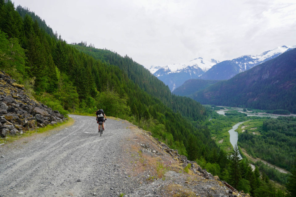
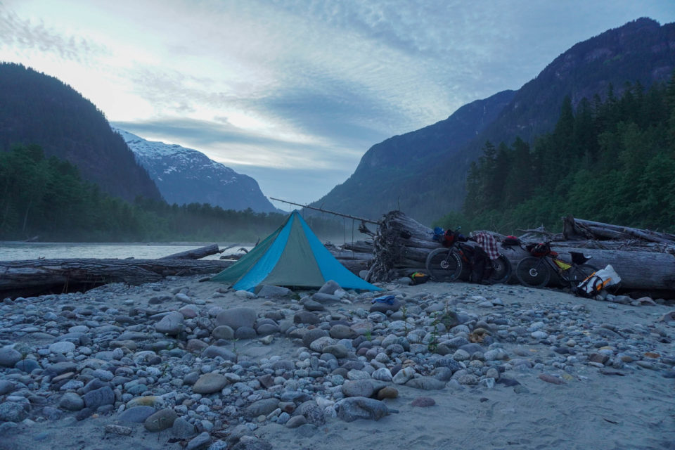
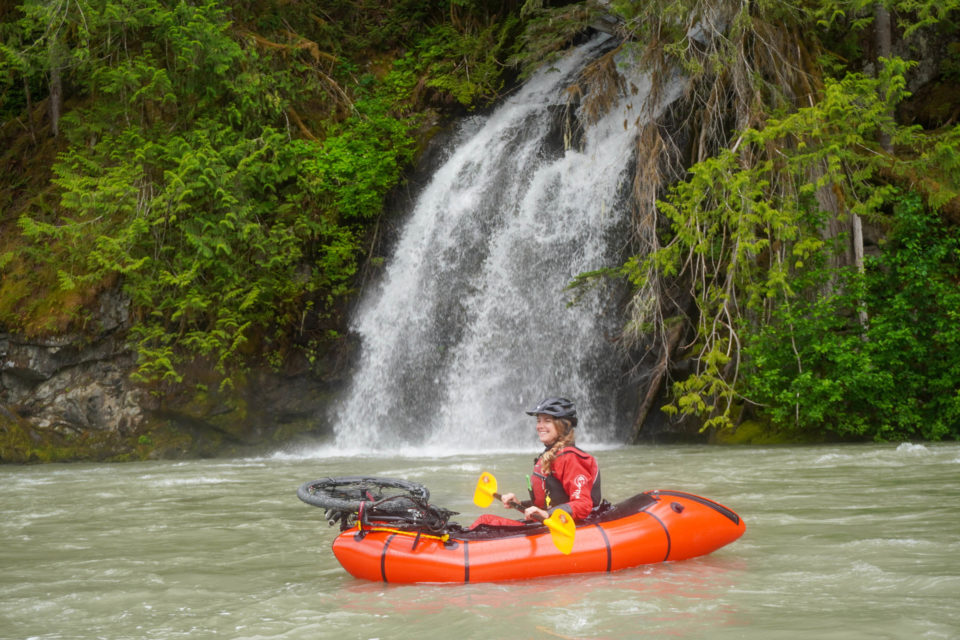
The Saw̓pa (Cloudburst Mountain) Divide is an overnight bikerafting route that travels through the traditional territory of the Sḵwx̱wú7mesh Úxwumixw (Squamish Nation) along two beautiful and verdant river valleys that abound with history. The riding is a mix of gravel roads, trails, and two very short paved sections, with a stunning Class II float back to the starting point.
The route is taken from https://bikepacking.com/
1. Lucille Lake
Altitude: 372 m
2. Landmarks and Village Sites
Altitude: 19 m
3. I’sik’shenm̓
Altitude: 33 m
5. Mountain Names
Altitude: 46 m
6. Yelhíxw/Riverside Camping
Altitude: 37 m
7. Ch’ekchekts
Altitude: 58 m
8. T’eḵt’aḵmúy̓in tl’a In7iny̓áx̱a7en (Black Tusk) Viewpoint
Altitude: 581 m
9. Ch’iyáḵmesh
Altitude: 51 m
10. S7iḵ’enáy̓ch - Squamish Atlas Landmark
Altitude: 103 m
11. Dropbar Cycles
Altitude: 11 m
12. Water
Altitude: 678 m
13. Creek
Altitude: 569 m
14. Backcountry Brewing
Altitude: 12 m
15. River Take Out - Fisherman's Park
Altitude: 18 m
16. Gravel Pit Campsite
Altitude: 684 m
17. Possible River Ford
Altitude: 64 m
18. River Put-In
Altitude: 58 m
19. Dispersed Camping
Altitude: 59 m
20. Squamish River Recreation Site
Altitude: 41 m
21. Skawshn/High Falls Creek Recreation Site
Altitude: 48 m
22. Freeman Lake
Altitude: 503 m
23. unnamed
Altitude: 506 m
24. Fergies Cafe
Altitude: 51 m